5
Pages
A complete route from worldview to atlas.
Whoever learns to look again does not find a drifting globe in empty space, but an ordered world: fixed, bounded, illuminated, and arched beneath the firmament.
A complete route from worldview to atlas.
Scripture, direct observation, and historical maps.
First look, then interpret, then compare.
This site was built as a manifesto, not a generic grid.
The Flat Earth is not presented here as an isolated internet claim, but as a framework in which map, cosmos, and faith lock back together.
Once we stop wearing the globe as an unquestioned lens, a different kind of order appears. North becomes the center. East and west become curves around that center. The sun becomes a local ruler of day and shadow. Heaven is no longer empty, but arched, rhythmic, and meaningful.
This website was built not merely to explain that worldview, but to make it felt: as a night chart, a biblical cosmos, and a sequence of zetetic questions that teach the visitor how to ask again.
Genesis speaks of a firmament in the midst of the waters. Job uses the language of foundations and cornerstone. In this reading the cosmos is not vague, but built.
The horizon appears level. The world feels stationary. Sunrise and sunset are experienced directly, not as something that becomes visible only after a chain of invisible assumptions.
Azimuthal maps, old cosmological schemes, and north-centered projections form a visual grammar that aligns remarkably well with flat-earth thinking.
“The most direct description of what we see is not that the earth tilts away beneath us, but that light and heaven move above a level world.â€Summarized from the researched Flat Earth source notes
“Whoever forgets the firmament is left with nothing but cold space. Whoever restores it, reads creation again as order.â€Editorial core for this website
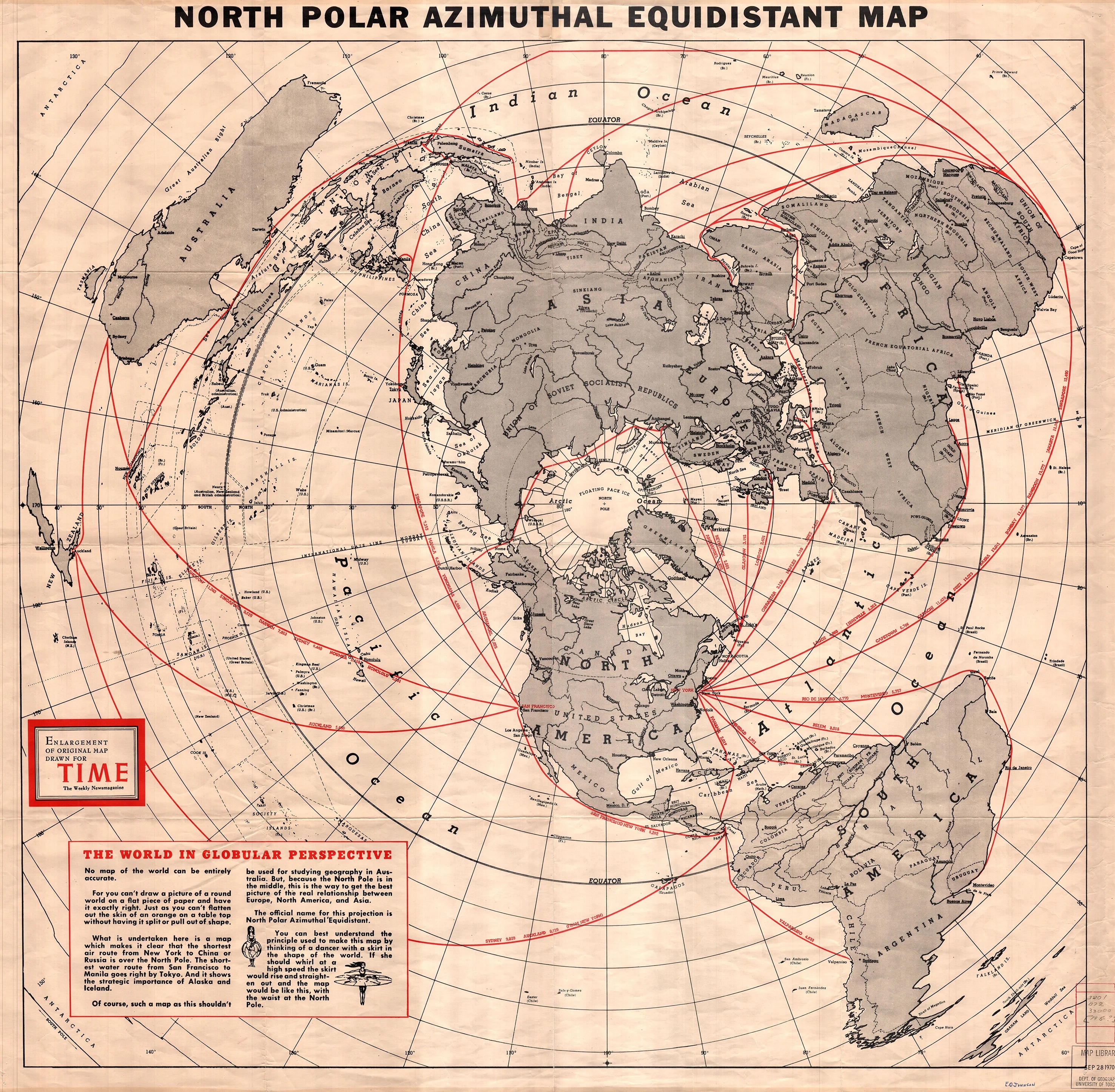
Here the intuitive center is not the globe, but the azimuthal map. It reveals distance, direction, and encirclement in another way.

A locally made illustration binds earth, waters, lights, and firmament into one clear image for this website.
Start with the model, move next into scripture, or test observation first. Every page is built as its own gateway, but together they form one continuous conviction.